My 7 Best Hikes in the Jungfrau Region (Eiger, Mönch & Jungfrau)
The Jungfrau region is one of the most spectacular hiking destinations in Switzerland. Here are seven incredible hikes around the Eiger, Mönch and Jungfrau, including panoramic trails near Lauterbrunnen, alpine lakes and scenic walks between mountain villages.
The best hikes in the Jungfrau region offer some of the most spectacular mountain scenery anywhere in the Alps.
Towering above deep valleys and alpine meadows are the legendary peaks of the Eiger, Mönch and Jungfrau – a dramatic trio that defines this famous part of the Bernese Oberland.
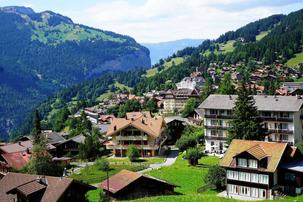
Base yourself in villages such as Lauterbrunnen, Wengen or Grindelwald and you’ll find an incredible variety of trails within easy reach.
Some walks lead beneath towering rock faces, others cross flower-filled alpine meadows, while several follow panoramic ridges with uninterrupted views of the high peaks.

In this guide I’ve selected seven of the best hikes in the Jungfrau region, ranging from easy scenic walks to more adventurous mountain trails.
Whether you want to stroll along a balcony path above the valley, hike beneath the famous north face of the Eiger, or visit one of Switzerland’s most beautiful alpine lakes, these routes showcase the very best of hiking in this remarkable part of Switzerland.
Best Hikes in the Jungfrau Region: Quick Overview
To help you choose the right trail, here’s a quick overview of the best hikes in the Jungfrau region, including distance, difficulty and highlights.
| Hike | Distance | Difficulty | Start Point | Highlights |
|---|---|---|---|---|
| Eiger Trail | 6 km | Moderate | Eigergletscher | Walk beneath the famous Eiger North Face |
| Männlichen → Kleine Scheidegg Panorama Trail | 4.5 km | Easy | Männlichen | Iconic views of the Eiger, Mönch and Jungfrau |
| First → Bachalpsee | 6 km return | Easy | Grindelwald First | Alpine lake with famous mountain reflections |
| Schynige Platte → Faulhorn → First | 16 km | Moderate–Hard | Schynige Platte | Epic ridge walk with huge Alpine panoramas |
| Lauterbrunnen Valley Walk | 6 km | Easy | Lauterbrunnen | Scenic valley with dramatic waterfalls |
| Grütschalp → Mürren Panorama Walk | 5 km | Easy | Grütschalp | Balcony trail with constant mountain views |
| Kleine Scheidegg → Wengen | 7–8 km | Easy–Moderate | Kleine Scheidegg | Beautiful downhill hike to a car-free village |
Below you’ll find more details about each hike, including what makes them special and why they deserve a place on your Jungfrau hiking itinerary.
1. Eiger Trail (Eigergletscher → Alpiglen)


Distance: 6 km | Time: ~2 hours | Difficulty: Moderate | Start: Eigergletscher | Finish: Alpiglen | Buy a Berner Oberland Regional Pass for easy travel.
The Eiger Trail is a classic walk in the Jungfrau region that runs along the base of the Eiger North Face.
You can reach the start point easily by train from Grindelwald or Kleine Scheidegg, or take the Eiger Express cable car for a faster and more scenic approach.
The path follows gentle scree slopes and opens out onto wide views across the Lauterbrunnen and Grindelwald valleys. In summer, wildflowers line the trail, and you might spot marmots or chamois along the way. Small streams and waterfalls add a peaceful background sound as you walk.
The trail is suitable for most walkers, but wearing good hiking shoes and carrying a light daypack with water and layers makes the walk more comfortable. You can pause at benches along the route to take in the views or snap photos of the peaks.

Planning tips: Buy a Berner Oberland Regional Pass in advance for access to Eigergletscher. Use mountain railways from Grindelwald, Lauterbrunnen and Wengen.
2. Männlichen → Kleine Scheidegg Panorama Trail

Distance: 4.5 km | Time: ~1 – 1.5 hours | Difficulty: Easy | Start: Männlichen | Finish: Kleine Scheidegg
This gentle ridge trail is ideal for easy hiking with views of the Eiger, Mönch, and Jungfrau. Take the Männlichen cable car from Wengen or Grindelwald to reach the start.
The trail is mostly flat, wide, and well-maintained, making it suitable for families or casual walkers. In summer, the slopes are dotted with wildflowers, and the valley views are constantly changing as you walk.
Planning tip: Bring a camera and a light jacket. The Männlichen cable car is covered by the Berner Oberland Pass (great value!)
3. First → Bachalpsee

Distance: 6 km return | Time: ~2 hours | Difficulty: Easy | Start: Grindelwald First | Finish: Bachalpsee
The walk from Grindelwald First to Bachalpsee leads to a calm alpine lake that reflects the surrounding mountains on clear days.
Take the First cable car to save energy and get started quickly.
The trail is mostly flat with short climbs, passing alpine meadows and ridges. Marmots are often seen in summer, and patches of wildflowers brighten the path.
The lake’s reflection of the Wetterhorn and Schreckhorn is particularly stunning in the morning.
Planning tip: Pack a snack and water for a picnic by the lake. The Grindelwald – First Cable Car is covered by the Berner Oberland Pass (great value!)
4. Schynige Platte → Faulhorn → First

Distance: 16 km | Time: ~6 hours | Difficulty: Moderate–Hard | Start: Schynige Platte | Finish: First
This ridge walk offers wide alpine views and passes by lakes and meadows before reaching Faulhorn summit, home to a historic mountain hotel.
You can reach the start by Schynige Platte cogwheel train from Wilderswil.
The hike includes rolling ridges, narrow paths, and exposed sections, giving a full-day experience of high alpine terrain. Wildflowers, grazing cows, and panoramic mountain views make it rewarding throughout.
Planning tip: Start early and bring plenty of water, snacks, and layers. Trekking poles and good boots will make the longer hike more comfortable.
5. Lauterbrunnen Valley Walk (Lauterbrunnen → Stechelberg)

Distance: 6 km | Time: ~1.5 – 2 hours | Difficulty: Easy | Start: Lauterbrunnen | Finish: Stechelberg
The Lauterbrunnen Valley Walk is a gentle, mostly flat route through one of Switzerland’s most scenic valleys.
Towering cliffs line either side, with waterfalls like Staubbach Falls and Trümmelbach Falls cascading dramatically into the valley.
Along the way, you’ll pass numerous traditional Swiss farms, adding a real sense of local life to the landscape.
In summer, paragliders often land in the valley, providing a touch of excitement as you stroll through the meadows.
The valley is dotted with small villages and green pastures, making for a calm and picturesque environment.
For those looking for a longer adventure, you can extend the walk into a loop via Mürren, using the cable cars at either end to make it convenient and still mostly flat.
6. Grütschalp → Mürren Panorama Walk

Distance: 5 km | Time: ~1.5 – 2 hours | Difficulty: Easy | Start: Grütschalp | Finish: Mürren
The trail from Grütschalp to Mürren is a classic balcony walk that gives hikers constant views of the Eiger, Mönch, and Jungfrau.
The path follows the edge of the Lauterbrunnen Valley, winding through forested sections and alpine meadows. From this vantage point, the valley drops steeply below, giving a true sense of the scale of the mountains.
This walk is gentle and family-friendly, making it perfect for a leisurely afternoon. Along the way, you can enjoy the peaceful alpine scenery, spot grazing cows, and take in the impressive panorama across the high peaks.
Arriving in the car-free village of Mürren is a reward in itself, with opportunities to relax at a café or explore the charming streets before returning by train or cable car.
7. Kleine Scheidegg → Wengen
Distance: 7–8 km | Time: ~2.5 – 3 hours | Difficulty: Easy–Moderate | Start: Kleine Scheidegg | Finish: Wengen
Descending from Kleine Scheidegg to Wengen is one of the most scenic downhill hikes in the Bernese Oberland.
The trail passes through alpine meadows and traditional Swiss farmhouses while offering continuous views of the Eiger’s north face and the surrounding peaks. Wildflowers bloom along the path in summer, adding colour to the green slopes.
Because the hike is mostly downhill, it is accessible to most walkers while still delivering dramatic scenery.
The trail gradually leads into the car-free village of Wengen, where you can enjoy a coffee or explore before catching a train back down the valley.
When is the Best Time to Hike in the Jungfrau Region?

The Jungfrau region offers remarkable hiking conditions from late spring through early autumn.
June to September is generally the most reliable period, with snow largely cleared from the trails and wildflowers in full bloom.
July and August are the warmest months and ideal for high-alpine routes like the Eiger Trail or the Schynige Platte – Faulhorn traverse, though trails can be busier during this peak season.
Late May or early October can offer quieter paths and beautiful autumn colours, but some cable cars and mountain services may be closed, and snow patches can linger at higher elevations.
Always check the weather and lift schedules before setting out – conditions in the Alps can change rapidly, even in summer.
Tips for Hiking in the Jungfrau Region
Start early to enjoy quieter trails and the best morning light, and always check cable car timetables if your trailhead is not accessible by foot.
Dress in layers, as the weather can shift quickly, and bring water, snacks, and sturdy footwear for rocky or muddy sections.
Respect wildlife and alpine flora, and take your time – part of the magic of these hikes is soaking in the scenery at a relaxed pace.
Best Hikes Jungfrau FAQ
Are the Jungfrau region hikes suitable for beginners?
Yes. Several hikes, like the Männlichen → Kleine Scheidegg Panorama Trail and Grütschalp → Mürren walk, are easy and suitable for most walkers. Trails vary in difficulty, so check distance and elevation before starting.
Do I need a car to hike in the Jungfrau region?
No. The region is well-connected by trains and cable cars. Villages like Lauterbrunnen, Wengen, and Grindelwald are accessible without a car, and many trailheads are reached directly by cable car or mountain train.
Which is the most scenic hike in the Jungfrau region?
It depends on what you want — the Eiger Trail offers dramatic views of the North Face, while the First → Bachalpsee trail features one of the most photographed alpine lakes. Ridge walks like Schynige Platte → Faulhorn provide panoramic vistas across the entire region.
When is the best time to hike in the Jungfrau region?
Late spring to early autumn (June–September) offers the most reliable conditions. Early summer brings wildflowers, while late September provides autumn colours and quieter trails. Always check local weather forecasts.
My Final Thoughts
The Jungfrau region is a paradise for walkers and hikers of all levels. From the dramatic north face of the Eiger to the tranquil waters of Bachalpsee, from gentle valley strolls in Lauterbrunnen to panoramic ridge walks above Mürren, the trails here showcase some of Switzerland’s most breathtaking landscapes.
Whether you’re seeking adventure, iconic mountain views, or a peaceful escape in the Alps, the seven hikes outlined here provide a perfect introduction to the region’s natural beauty. Pack your boots, grab your camera, and set out on one of the world’s most spectacular hiking experiences – the Jungfrau awaits.